human219
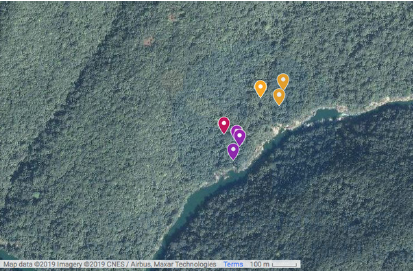
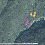
Figure 5: Map of the Nam Noy field site with the location
of the collection sites. Generated using ©Google Maps.
Purple, red and yellow marks show the collection
locations in the riverside habitat, low-cover forest habitat,
and high-cover forest habitat, respectively.
« Previous Image | Full-Size Image | Main Gallery Page | Next Image »