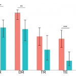
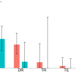
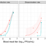
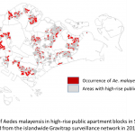
Other Images in this Gallery
-
-
-
Figure 1. Map showing sampling locations of mosquitoes in Lao PDR. KM = Khammuane Province; Black stars = sampling locations; Blue line = Mekong River and its tributaries.
-
-
-
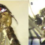
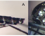
Figure 3: Morphological comparison of the abdominal terga IV-VI. (A) Ae. malayensis – dorsal white bands connected to lateral pale patches. (B) Ae. albopictus – dorsal white bands separated from lateral spots.
-
-
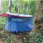
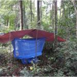
Figure 4: Human-baited double-net traps in situ.
-
-
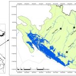
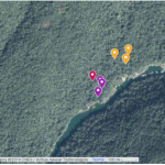
Figure 5: Map of the Nam Noy field site with the location
of the collection sites. Generated using ©Google Maps.
Purple, red and yellow marks show the collection
locations in the riverside habitat, low-cover forest habitat,
and high-cover forest habitat, respectively.
-
-
-
-
-
-
-

-
-
-